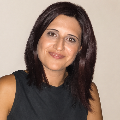
Η Δρ. Αργυρώ Αργυρού εργάζεται ως ερευνήτρια στο Τμήμα Πολιτικών Μηχανικών και Μηχανικών Γεωπληροφορικής του Τεχνολογικού Πανεπιστημίου Κύπρου (ΤΕΠΑΚ). Η έρευνά της επικεντρώνεται στη χωρική ανάλυση, τη χαρτογραφία, την τεχνητή νοημοσύνη, την παρατήρηση της Γης και τη γεωπληροφορική, με εφαρμογές στην αρχαιολογική έρευνα και τη μελέτη τοπίων πολιτιστικής κληρονομιάς. Στο πλαίσιο της ερευνητικής της δραστηριότητας συμμετέχει σε ευρωπαϊκά και εθνικά ερευνητικά έργα που σχετίζονται με την καινοτόμο χρήση τεχνολογιών τηλεπισκόπησης και μηχανικής μάθησης για την προστασία και ανάδειξη της πολιτιστικής κληρονομιάς.
Ολοκλήρωσε τις προπτυχιακές της σπουδές ως Τεχνολόγος Γραφικών Τεχνών στο Πανεπιστήμιο Δυτικής Αττικής. Στη συνέχεια, απέκτησε μεταπτυχιακό τίτλο (MSc in GIS) από το University of Leeds (School of Geography), όπου η διατριβή της επικεντρώθηκε στη χωρική ανάλυση κληρονομικών γονιδιακών ασθενειών στην Κύπρο. Ως απόφοιτος του Πανεπιστημίου Leeds συμμετέχει στο πρόγραμμα Mentoring Scheme της Σχολής Γεωγραφίας, υποστηρίζοντας νέους φοιτητές σε θέματα γεωπληροφορικής.
Απέκτησε το διδακτορικό της στο Τμήμα Πολιτικών Μηχανικών και Μηχανικών Γεωπληροφορικής του ΤΕΠΑΚ υπό την επίβλεψη του Καθηγητή Άθου Αγαπίου. Η διδακτορική της έρευνα εστίασε στην ανίχνευση και ταξινόμηση επιφανειακής αρχαιολογικής κεραμικής με χρήση δεδομένων τηλεπισκόπησης χαμηλού ύψους και αλγορίθμων μηχανικής μάθησης, αναπτύσσοντας μια καινοτόμο μεθοδολογία εντοπισμού επιφανειακών αρχαιολογικών ευρημάτων με τη χρήση τεχνητής νοημοσύνης.
Παράλληλα με την ακαδημαϊκή της πορεία, από το 2003 εργάζεται στο Τμήμα Κτηματολογίου και Χωρομετρίας της Κύπρου, στον Κλάδο Χαρτογραφίας, όπου ασχολείται με την επεξεργασία και ανάλυση γεωχωρικών δεδομένων, τη διαχείριση χαρτογραφικών βάσεων δεδομένων και την παραγωγή χαρτογραφικών προϊόντων. Διαθέτει πολυετή εμπειρία σε θέματα GIS (συλλογή, επεξεργασία και ανάλυση χωρικών δεδομένων) και χαρτογραφίας.
Στο πλαίσιο της ερευνητικής της δραστηριότητας, έχει συμμετάσχει σε έργα όπως τα ENSURE, ENGINEER, CONNECTING και DEPLOYED, συμβάλλοντας στην ανάπτυξη και εφαρμογή καινοτόμων μεθόδων για την ανίχνευση, παρακολούθηση και προστασία πολιτιστικής κληρονομιάς μέσω τηλεπισκόπησης και τεχνητής νοημοσύνης.
Παράλληλα, συμμετέχει ως μέλος στο Earth Observation Cultural Heritage Research Lab του ΤΕΠΑΚ, στην UNESCO Chair on Digital Cultural Heritage, στο MNEMOSYNE Research Centre (Digital Cultural Heritage Unit) και στο ESRI User Community for Geospatial Authorities.
Επιλεκτικές Δημοσιεύσεις
- Argyrou A., Agapiou, A. (2022). A review of artificial intelligence and remote sensing for archaeological research. Remote Sensing, 14(23), 6000. https://doi.org/10.3390/rs14236000
- Argyrou A., Agapiou, A., Papakonstantinou, A., Alexakis, D.D. (2023). Comparison of Machine Learning Pixel-Based Classifiers for Detecting Archaeological Ceramics. Drones, 7, 578. https://doi.org/10.3390/drones7090578
- Argyrou, A., Papakonstantinou, A., Christoforou, M., Alexakis, D.D., Agapiou, A. (2025). Detection of Archaeological Surface Ceramics Using Very High-Resolution Remotely Sensed Data. In: Pavlidis, G., Sylaiou, S. (eds) Transforming Heritage Research in a Transforming World: 5th CAA-GR Conference 2024. CAA-GR 2024. Springer Proceedings in Archaeology and Heritage. Springer, Cham. https://doi.org/10.1007/978-3-032-06389-2_4